BOOKS - HISTORY - The Family Tree Historical Atlas of Germany

The Family Tree Historical Atlas of Germany
Author: James Beidler
Year: 2019
Format: PDF
File size: 42,5 MB
Language: ENG

Year: 2019
Format: PDF
File size: 42,5 MB
Language: ENG

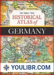
The Family Tree Historical Atlas of Germany is a comprehensive collection of historical maps that provides a unique perspective on the rich and complex history of Germany. The atlas features over 100 full-color maps that chronicle the changing borders and territories of Germany from the early Middle Ages to the present day, offering a visual representation of the country's evolution over time. This valuable resource is essential for anyone looking to explore their German heritage or gain a deeper understanding of the nation's history. The atlas begins with the early Middle Ages, showcasing the fragmented political landscape of the region before the formation of modern-day Germany. As you turn the pages, you'll witness the progression of the Holy Roman Empire, the Thirty Years War, and the unification of Germany under Prussian leadership. Each map provides a clear and concise visual representation of the shifting borders and territorial claims, making it easy to follow the development of the country through the centuries. One of the most significant benefits of this atlas is its ability to help individuals trace their family history and ancestry.
Family Tree Historical Atlas of Germany - это всеобъемлющая коллекция исторических карт, которая дает уникальный взгляд на богатую и сложную историю Германии. В атласе представлено более 100 полноцветных карт, которые описывают меняющиеся границы и территории Германии от раннего Средневековья до наших дней, предлагая визуальное представление об эволюции страны во времени. Этот ценный ресурс необходим всем, кто хочет изучить свое немецкое наследие или получить более глубокое понимание истории страны. Атлас начинается с раннего Средневековья, демонстрируя фрагментированный политический ландшафт региона до образования современной Германии. Перелистывая страницы, вы станете свидетелем развития Священной Римской империи, Тридцатилетней войны и объединения Германии под руководством Пруссии. Каждая карта дает четкое и лаконичное визуальное представление о смещающихся границах и территориальных претензиях, позволяя легко следить за развитием страны на протяжении веков. Одним из наиболее значительных преимуществ этого атласа является его способность помогать людям отслеживать свою семейную историю и родословную.
Family Tree Historical Atlas of Germany est une collection complète de cartes historiques qui donne un aperçu unique de l'histoire riche et complexe de l'Allemagne. L'atlas présente plus de 100 cartes en couleur qui décrivent l'évolution des frontières et des territoires de l'Allemagne du début du Moyen Age à nos jours, offrant une vue visuelle de l'évolution du pays dans le temps. Cette ressource précieuse est nécessaire pour tous ceux qui veulent explorer leur héritage allemand ou acquérir une meilleure compréhension de l'histoire du pays. L'atlas commence au début du Moyen Age, montrant le paysage politique fragmenté de la région avant la formation de l'Allemagne moderne. En feuilletant les pages, vous assisterez au développement du Saint Empire romain, à la guerre de Trente Ans et à l'unification de l'Allemagne sous la direction de la Prusse. Chaque carte donne une vue visuelle claire et concise des frontières changeantes et des revendications territoriales, ce qui permet de suivre facilement le développement du pays au fil des siècles. L'un des avantages les plus importants de cet atlas est sa capacité à aider les gens à suivre leurs antécédents familiaux et leur lignée.
Familia Árbol Histórico Atlas de Alemania es una colección completa de mapas históricos que ofrece una visión única de la rica y compleja historia de Alemania. atlas presenta más de 100 mapas a todo color que describen las fronteras y territorios cambiantes de Alemania desde principios de la Edad Media hasta la actualidad, ofreciendo una visión visual de la evolución del país en el tiempo. Este valioso recurso es necesario para cualquiera que quiera explorar su legado alemán o adquirir una comprensión más profunda de la historia del país. Atlas comienza a principios de la Edad Media, mostrando el paisaje político fragmentado de la región antes de la formación de la Alemania moderna. Al pasar las páginas, usted será testigo del desarrollo del Sacro Imperio Romano Germánico, la Guerra de los Treinta Años y la unificación de Alemania bajo la dirección de Prusia. Cada mapa ofrece una visión visual clara y concisa de las fronteras cambiantes y las reivindicaciones territoriales, lo que permite seguir con facilidad el desarrollo del país a lo largo de los siglos. Uno de los beneficios más significativos de este atlas es su capacidad para ayudar a las personas a rastrear su historia familiar y linaje.
A Família Tree Historical Atlas of Germany é uma coleção completa de mapas históricos que oferece uma visão única da rica e complexa história da Alemanha. O atlas apresenta mais de 100 mapas a cores completas que descrevem as fronteiras em evolução e os territórios alemães desde o início da Idade Média até hoje, oferecendo uma visão visual da evolução do país no tempo. Este recurso valioso é necessário para todos aqueles que querem explorar o seu legado alemão ou obter uma compreensão mais profunda da história do país. O Atlas começa no início da Idade Média, mostrando a paisagem política fragmentada da região antes da formação da Alemanha moderna. Ao folhear as páginas, você vai testemunhar o desenvolvimento do Império Romano Sagrado, a Guerra dos Trinta Anos e a união da Alemanha sob a liderança da Prússia. Cada mapa oferece uma visão visual clara e concisa dos limites que se deslocam e das reivindicações territoriais, permitindo acompanhar facilmente o desenvolvimento do país ao longo dos séculos. Uma das vantagens mais significativas deste atlas é a sua capacidade de ajudar as pessoas a seguir a sua história familiar e linhagem.
Family Tree Historical Atlas of Germany è una collezione completa di mappe storiche che offre una visione unica della ricca e complessa storia tedesca. L'atlante presenta oltre 100 mappe a colori che descrivono i confini e i territori della Germania che cambiano dal primo Medioevo a oggi, offrendo una visione visiva dell'evoluzione del paese nel tempo. Questa preziosa risorsa è necessaria per tutti coloro che vogliono esplorare il proprio patrimonio tedesco o acquisire una maggiore comprensione della storia del paese. Atlante inizia al primo Medioevo, mostrando il panorama politico frammentato della regione prima della formazione della Germania moderna. Ripassando le pagine, assisterete allo sviluppo del Sacro Romano Impero, alla Guerra dei Trent'anni e all'unificazione tedesca sotto la guida della Prussia. Ogni mappa fornisce una visione visiva chiara e concisa dei confini che si spostano e delle rivendicazioni territoriali, permettendo di seguire facilmente l'evoluzione del paese nel corso dei secoli. Uno dei vantaggi più significativi di questo atlante è la sua capacità di aiutare le persone a monitorare la loro storia familiare e lignea.
Stammbaum Der historische Atlas Deutschlands ist eine umfassende Sammlung historischer Karten, die einen einzigartigen Einblick in die reiche und komplexe Geschichte Deutschlands gibt. Der Atlas zeigt mehr als 100 vollfarbige Karten, die die sich ändernden Grenzen und Territorien Deutschlands vom frühen Mittelalter bis zur Gegenwart beschreiben und einen visuellen Einblick in die Entwicklung des Landes im Laufe der Zeit bieten. Diese wertvolle Ressource ist unerlässlich für alle, die ihr deutsches Erbe erkunden oder einen tieferen Einblick in die Geschichte des Landes erhalten möchten. Der Atlas beginnt im frühen Mittelalter und zeigt die fragmentierte politische Landschaft der Region bis zur Entstehung des modernen Deutschlands. Wenn e die Seiten durchblättern, werden e Zeuge der Entwicklung des Heiligen Römischen Reiches, des Dreißigjährigen Krieges und der Vereinigung Deutschlands unter der Führung Preußens. Jede Karte bietet eine klare und prägnante visuelle Darstellung der sich verändernden Grenzen und territorialen Ansprüche, so dass e die Entwicklung des Landes im Laufe der Jahrhunderte leicht verfolgen können. Einer der wichtigsten Vorteile dieses Atlas ist seine Fähigkeit, Menschen zu helfen, ihre Familiengeschichte und Abstammung zu verfolgen.
Drzewo rodzinne Atlas historyczny Niemiec to kompleksowa kolekcja map historycznych, która zapewnia unikalną perspektywę na bogatą i złożoną historię Niemiec. Atlas posiada ponad 100 pełnokolorowych map, które opisują zmieniające się granice i terytoria Niemiec od wczesnego średniowiecza do teraźniejszości, oferując wizualne przedstawienie ewolucji kraju w czasie. Ten cenny zasób jest niezbędny dla każdego, kto chce studiować swoje dziedzictwo niemieckie lub uzyskać głębsze zrozumienie historii kraju. Atlas rozpoczyna się we wczesnym średniowieczu, ukazując rozdrobniony krajobraz polityczny regionu przed powstaniem współczesnych Niemiec. Obracając strony, będziecie świadkami rozwoju Świętego Cesarstwa Rzymskiego, wojny trzydziestoletniej i zjednoczenia Niemiec pod przywództwem Prus. Każda mapa zapewnia jasne i zwięzłe wizualne przedstawienie przesuniętych granic i roszczeń terytorialnych, ułatwiając śledzenie rozwoju kraju na przestrzeni wieków. Jedną z najważniejszych zalet tego atlasu jest jego zdolność do pomocy ludziom w śledzeniu ich rodzinnej historii i przodków.
האטלס ההיסטורי של עץ המשפחה של גרמניה הוא אוסף מקיף של מפות היסטוריות המספקות נקודת מבט ייחודית על ההיסטוריה העשירה והמורכבת של גרמניה. האטלס כולל יותר מ-100 מפות צבעוניות המתארות את הגבולות והשטחים המשתנים של גרמניה מימי הביניים ועד ימינו, המציעות ייצוג חזותי של התפתחות המדינה לאורך זמן. משאב יקר זה נחוץ לכל מי שרוצה ללמוד את המורשת הגרמנית שלו או לרכוש הבנה עמוקה יותר של ההיסטוריה של המדינה. האטלס מתחיל בימי הביניים המוקדמים, מראה את הנוף הפוליטי המקוטע של האזור לפני היווצרות גרמניה המודרנית. הפיכת הדפים, אתה תהיה עד להתפתחותה של האימפריה הרומית הקדושה, מלחמת שלושים השנים ואיחוד גרמניה תחת הנהגת פרוסיה. כל מפה מספקת ייצוג חזותי ברור ותמציתי של שינויי גבולות ותביעות טריטוריאליות, המקלים על התפתחות המדינה לאורך הדורות. אחד היתרונות המשמעותיים ביותר של אטלס זה הוא היכולת שלו לעזור לאנשים לעקוב אחר ההיסטוריה המשפחתית שלהם ושושלת.''
Family Tree Historical Atlas of Germany, Almanya'nın zengin ve karmaşık tarihine benzersiz bir bakış açısı sağlayan kapsamlı bir tarihi harita koleksiyonudur. Atlas, Almanya'nın Orta Çağ'dan günümüze değişen sınırlarını ve bölgelerini tanımlayan ve ülkenin zaman içindeki evriminin görsel bir temsilini sunan 100'den fazla tam renkli haritaya sahiptir. Bu değerli kaynak, Alman mirasını incelemek veya ülkenin tarihini daha iyi anlamak isteyen herkes için gereklidir. Atlas, Orta Çağ'ın başlarında başlar ve modern Almanya'nın oluşumundan önce bölgenin parçalanmış siyasi manzarasını gösterir. Sayfaları çevirirken, Kutsal Roma İmparatorluğu'nun gelişimine, Otuz Yıl Savaşı'na ve Almanya'nın Prusya önderliğinde birleşmesine tanık olacaksınız. Her harita, değişen sınırların ve toprak iddialarının açık ve özlü bir görsel temsilini sağlar ve ülkenin yüzyıllar boyunca gelişimini takip etmeyi kolaylaştırır. Bu atlasın en önemli faydalarından biri, insanların aile geçmişlerini ve atalarını izlemelerine yardımcı olma yeteneğidir.
Family Tree Historical Atlas of Germany هو مجموعة شاملة من الخرائط التاريخية التي توفر منظورًا فريدًا لتاريخ ألمانيا الغني والمعقد. يتميز الأطلس بأكثر من 100 خريطة كاملة الألوان تصف الحدود والأقاليم المتغيرة لألمانيا من أوائل العصور الوسطى إلى الوقت الحاضر، مما يوفر تمثيلًا مرئيًا لتطور البلاد بمرور الوقت. هذا المورد القيم ضروري لكل من يريد دراسة تراثه الألماني أو اكتساب فهم أعمق لتاريخ البلاد. يبدأ الأطلس في أوائل العصور الوسطى، ويظهر المشهد السياسي المجزأ للمنطقة قبل تشكيل ألمانيا الحديثة. عند قلب الصفحات، ستشهد تطور الإمبراطورية الرومانية المقدسة، وحرب الثلاثين عامًا وتوحيد ألمانيا تحت قيادة بروسيا. توفر كل خريطة تمثيلاً مرئيًا واضحًا وموجزًا للحدود المتغيرة والمطالبات الإقليمية، مما يجعل من السهل متابعة تطور البلاد على مر القرون. واحدة من أهم فوائد هذا الأطلس هي قدرته على مساعدة الناس على تتبع تاريخ عائلاتهم وأصولهم.
독일의 패밀리 트리 역사 아틀라스는 독일의 풍부하고 복잡한 역사에 대한 독특한 관점을 제공하는 포괄적 인 역사지도 모음입니다. 아틀라스는 중세 초기부터 현재까지 독일의 변화하는 국경과 영토를 설명하는 100 개가 넘는 풀 컬러지도를 특징으로하며 시간이 지남에 따라 국가의 진화를 시각적으로 표현합니다. 이 귀중한 자료는 독일 문화 유산을 연구하거나 국가 역사를 더 깊이 이해하려는 모든 사람에게 필요합니다. 아틀라스는 중세 초기에 시작되어 현대 독일이 형성되기 전에이 지역의 분열 된 정치 환경을 보여줍니다. 페이지를 넘기면 프로이센의지도하에 신성 로마 제국의 발전, 30 년 전쟁 및 독일 통일을 목격 할 것입니다. 각지도는 변화하는 국경과 영토 주장에 대한 명확하고 간결한 시각적 표현을 제공하여 수세기에 걸쳐 국가의 발전을 쉽게 따라갈 수 있습니다. 이 아틀라스의 가장 중요한 이점 중 하나는 사람들이 가족의 역사와 조상을 추적 할 수 있도록 돕는 능력입니다.
家系図ドイツの歴史地図は、ドイツの豊かで複雑な歴史のユニークな視点を提供する歴史地図の包括的なコレクションです。このアトラスには、中世初期から現在にかけてのドイツの国境や領土の変化を示す100以上のフルカラーマップがあり、時間を通して国の進化を視覚的に表現しています。この貴重なリソースは、ドイツの遺産を研究したり、国の歴史をより深く理解したい人にとって必要です。アトラスは中世初期に始まり、現代ドイツが形成される以前の地域の断片化された政治的景観を示している。ページをめくると、あなたは神聖ローマ帝国の発展、三十戦争、プロイセンの指導の下でドイツの統一を目撃するでしょう。各マップは、国境や領土の主張を明確かつ簡潔に表示し、何世紀にもわたって国の発展に簡単に従うことができます。このアトラスの最も重要な利点の1つは、人々が自分の家族の歴史と祖先を追跡するのを助ける能力です。
德國家庭樹歷史地圖集是歷史地圖的綜合集合,為德國豐富而復雜的歷史提供了獨特的視角。地圖集提供了100多張全彩地圖,描述了從中世紀早期到當今德國不斷變化的邊界和領土,提供了該國隨時間演變的視覺視圖。任何想要探索自己的德國遺產或更深入了解該國歷史的人都需要這種寶貴的資源。地圖集始於中世紀早期,展示了該地區支離破碎的政治景觀,直到現代德國的形成。翻閱頁面,你會見證神聖羅馬帝國的發展,三十戰爭和普魯士領導的德國統一。每張地圖都為不斷變化的邊界和領土主張提供了清晰而簡潔的視覺視圖,使人們可以輕松地觀察幾個世紀以來該國的發展。該地圖集最重要的好處之一是它能夠幫助人們跟蹤其家族歷史和血統。


